| dc.publisher | North Dakota State University | en_US |
| dc.title | South "Bent" Pyramid | en_US |
| dc.type | Image | en_US |
| local.fileFormat | .jpeg | en |
| local.transmissionData | From slide using Nikon Coolscan 5000 | en |
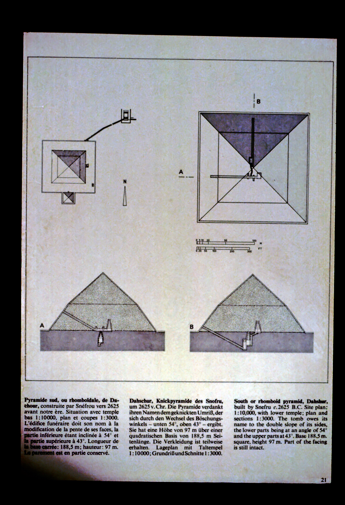
| dc.description | Site plan of south pyramid. The tomb owes its name to the double slope of its sides, the lower parts being at an angle of 54 degrees and the upper parts being at 43 degrees. Base 188.5m. square, height 97 m. Part of the facing is still intact (2723 BC) | en |
| dc.date.accessioned | 2008-08-21T16:21:10Z | |
| dc.date.available | 2008-08-21T16:21:10Z | |
| dc.date.issued | 2008-08-21T16:21:10Z | |
| dc.identifier.uri | http://hdl.handle.net/10365/68 | |
| local.architect/builder | N/A | |
| local.photographer | N/A | |
| local.dateOfPhotograph | N/A | |
| local.rightsHolder | NDSU Architecture and Landscape Architecture Library | |
| dc.subject.lcsh | Architecture. | en_US |
| dc.subject.lcsh | Pyramids. | en_US |
| dc.subject.lcsh | Architecture, Egyptian. | en_US |
| dc.identifier | ALA00048 | |
| dc.description.locationCity | Dahshur | en_US |
| dc.description.locationCountry | Egypt | en_US |
| dc.description.view | Plan and Sections | en_US |