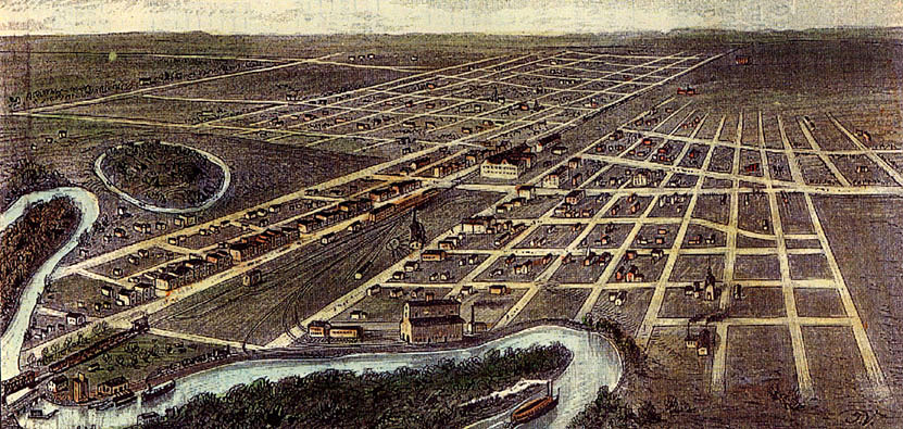
Map of Fargo in 1884

The map above was produced in 1884 by Rossi in Italy. It was produced to encourage Italian immigration to America.
The Northern Pacific railroad bridge across the Red River is in the lower left corner. Parallel to the train tracks we can see Front Street (Main Avenue) on the left (south) and N.P. Avenue to the right (north) of the tracks. Note that the only bridge across the river was the railroad bridge and a small wagon and pedestrian bridge just to its north.
Island Park is unmistakable by the road that rings it. The large building between Front Street and N.P. Avenue in the center is the Headquarters Hotel.
In the lower left just north of the bridges, the steamboat landing is depicted. In the lower center, next to the river, is the Union Elevator.
